![]()
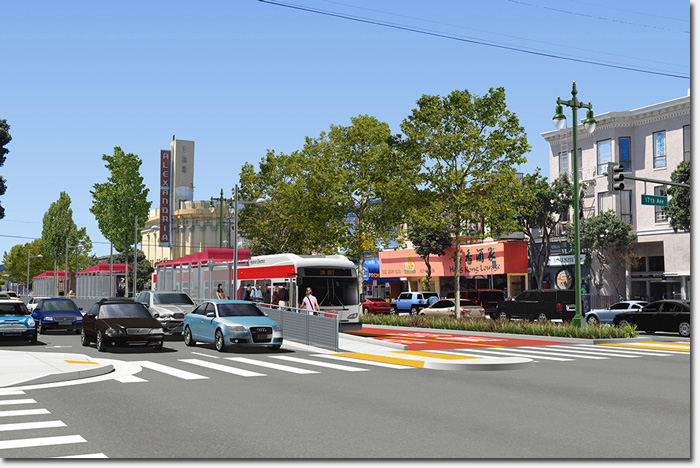
A rendering of the center-lane configuration at Geary and 17th Avenue
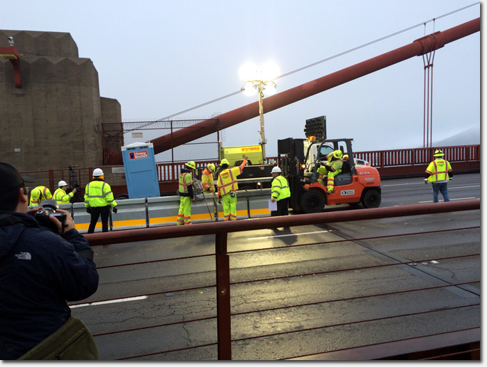
The Geary Bus Rapid Transit Project, aka Geary BRT, reached a key milestone earlier this month: publication of the final Environmental Impact Report (EIR). This final report responds to all comments received on the Draft EIR in 2015, and includes analysis of several modifications to the project’s design made in response to public input received.
The Geary BRT project proposes the creation of dedicated bus lanes along Geary Boulevard spanning from Market Street all the way out to 34th Avenue, as well as accompanying improvements to pedestrian safety, landscaping, street paving, and street lighting.
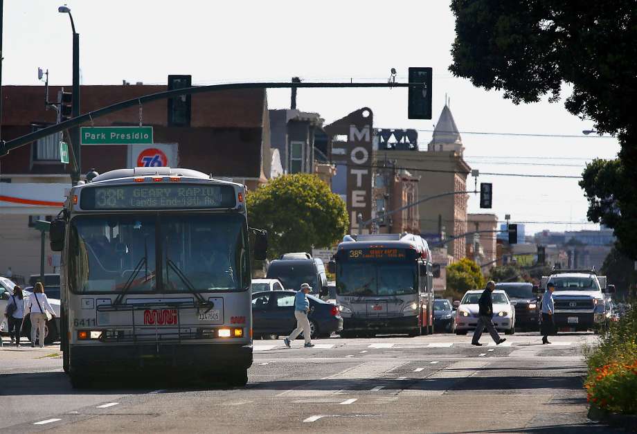
The end goal of the Geary BRT is to speed up transit service along the busy Geary corridor, which the SFMTA estimates serves over 52,000 riders on an average weekday via the 38 Geary bus lines.
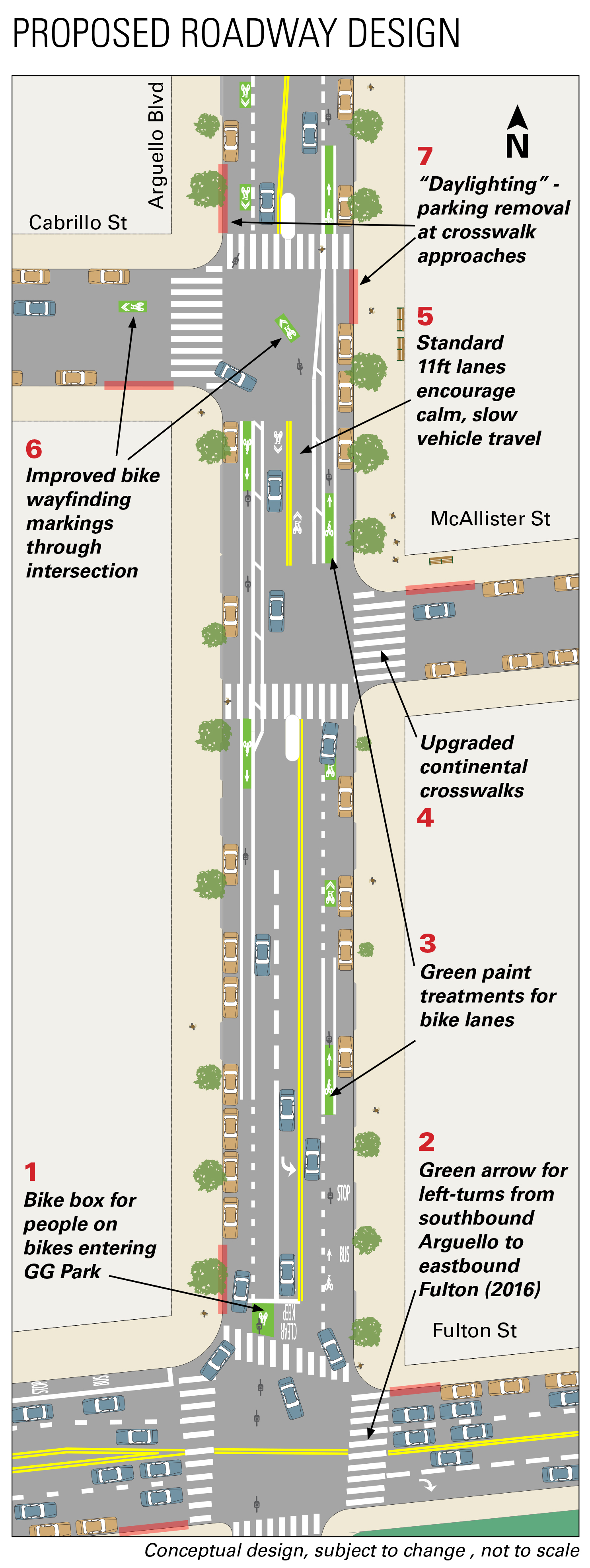
The dedicated bus lane for the 38 Geary would be a “side-running” configuration from Market Street out to Arguello, in which a lane alongside the curb lane, or in some cases hugging the curb itself, would be painted red and reserved for buses and taxis only. Many of these are in use in the city currently.
![]()
Alternative 2 in the EIR. Side-Lane Bus Rapid Transit
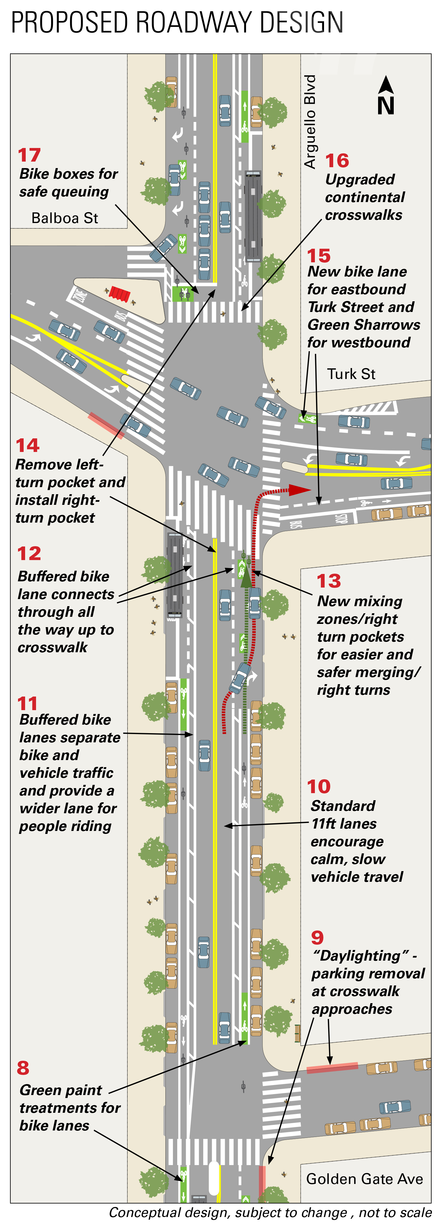
However once the bus reaches Arguello, it becomes a “center lane” configuration, in which two lanes in the center of Geary would be cordoned off just for bus traffic. New passenger loading medians would adjoin the lanes on blocks where there are stops. This center lane configuration would run out to 25th Avenue.
From 25th Avenue until 34th Avenue, it would return to a side-running configuration.
![]()
“Alternative 3” in the EIR. Center-Lane Bus Rapid Transit with Dual Medians and Passing Lanes
In recent years, the SFMTA has made small improvements to the 38 Geary service including more frequent 38 Geary Rapid service (it now runs every 4 minutes during peak periods, down from every 5.5 minutes in 2015), the addition of 38 Rapid service on Sunday’s, as well as a Transit Signal Priority program in which sensors mounted at intersections help prolong green lights when buses are approaching.
The Potential Pot-Holes of Geary BRT
While everyone would agree that more efficient transit is needed in San Francisco, especially to connect the western “Outside Lands” with downtown, the Geary BRT project is not without its critics.
Merchants along the Geary corridor, especially in the Richmond District, fear that the multiple years of construction required to complete the project would all but kill their businesses, and that the dedicated bus lanes would result in lost parking spaces along Geary Boulevard.
Others believe that the $300 million price tag is much too high just to save a few minutes in bus commute time. In their latest FAQ, the SFMTA estimates that the BRT will “save people who rely on Geary bus routes an average of 20 minutes round trip” (or 10 minutes each way).
This last year, the Geary BRT team at the SFMTA, which includes a 13-member Citizens Advisory Committee (CAC), has been out in the community working to understand concerns and issues that community groups and residents have with the proposed project. In some cases, these meetings with the community resulted in changes that are reflected in the final EIR.
One organization they met with was the Holy Virgin Cathedral on Geary between 26th and 27th Avenues, who are concerned that the loss of parking from the Geary BRT will inconvenience their members. As a result, the SFMTA proposed to convert some parallel parking spots on adjoining streets to perpendicular parking to create more spaces.
The Geary Merchants Association has been one of the most vocal critics of the Geary BRT, and launched savegearyblvd.org. The SFMTA says they have met with the group’s leader, David Heller, and that they have developed a set of strategies to minimize merchant disruption during the Geary BRT implementation.
These strategies include minimizing the duration of construction on a given block, forming a business advisory committee, and surveying merchants along Geary in person to better understand their business needs such as key delivery times to their storefronts.
How Geary BRT May Affect Drivers
One of the greatest cries heard against Geary BRT is the resulting loss of parking along Geary, particularly in the commercial portions of the Richmond District. Based on the final EIR, the SFMTA told us that the total amount of car parking is “more or less a wash”, stating that “more than 95% of parking with 1-2 blocks of the corridor would be retained”.
In the center lane configuration, the current perpendicular parking along Geary will convert to parallel parking, but the former bus zones on Geary will also become parallel parking spaces, effectively canceling out the loss from the conversion. And as described above with the Holy Virgin Cathedral, some changes will be made on side streets along Geary to accommodate more parking.
Drivers have also been concerned about the potential slow-downs that the BRT will bring to Geary by removing car driving lanes, installing more pedestrian safety measures meant to reduce traffic speeds, and the additional of bike lanes to Geary.
However the SFMTA maintains that the Geary BRT implementation will have a positive impact on drive times and driver experiences along Geary.
“By giving buses a dedicated lane, buses can move efficiently from stop to stop without conflicts with other vehicles. And, by removing buses from mixed traffic, cars won’t queue behind loading buses,” the SFMTA states. All right turns, and most left turns will also be preserved along Geary (unlike its sister BRT project along Van Ness where nearly all left turns are being removed).
And in what some would argue is one of the biggest bets being made by the SFMTA, they claim, “When transit is quick and convenient, fewer people drive.”
Despite the SFMTA’s belief that a majority of people will just stop driving in San Francisco if given better transit options, we were told that the EIR does account for traffic growth by the time the project would debut in 2020 and as far out as 2035.
“Some intersections would have additional congestion, but at others there would be less congestion because people would switch to riding the bus or driving outside of prime times,” the SFMTA told us during our press briefing.
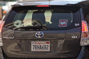
The Geary BRT project has been in the works since the early 2000’s, long before people were turning their cars into money-making taxis and hailing rides on their smartphones. Recently, the SFMTA submitted a filing to the California Public Utilities Commission, blaming the estimated 45,000 Uber and Lyft drivers for the city’s traffic congestion, ranked among the worst in US cities.
When we asked if the EIR’s traffic projections accounts for the anticipated impact of the growing industry for Uber’s and Lyft’s, we were told that it does.
Public Meeting for EIR on January 7
The final Geary BRT EIR will be under review at an upcoming public meeting of the San Francisco Country Transit Authority (SFCTA) on Thursday, January 5, 2017 (2pm, City Hall, Room 250). At that meeting, the SFCTA will be asked to certify the EIR, which includes approving the design and configuration described in the EIR. The meeting, which will not be the last public discourse on the Geary BRT, is an opportunity for members of the public to speak their views on the Geary BRT project.
If the EIR is approved at the January 7 meeting, the project will then go into final design planning, which culminates with the SFMTA Board taking action to legislate every one of the recommended changes for the project.
But given the historic pace of the Geary BRT project so far, that is a ways off. The earliest any construction would begin is in 2018 on the downtown portions of Geary. It would not be until late 2019 / early 2020 that any construction would occur west of Stanyan.
To find out more about the Geary BRT and the release of the final EIR, please visit gearybrt.org.
UPDATE January 12, 2017: On 1/5/17, The Geary Bus Rapid Transit (BRT) project and its Final Environmental Impact Report (EIR) were approved unanimously by the SF County Transportation Authority (SFCTA) Board, which is comprised of the SF Board of Supervisors. [via SFMTA]
Sarah B.


 The city is considering removing parking spaces in several neighborhoods to make way for Uber and Lyft loading zones, with the hopes of alleviating double parking and other hazards that the ride company drivers present to every day traffic.